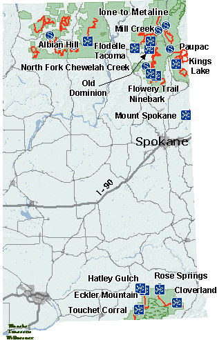
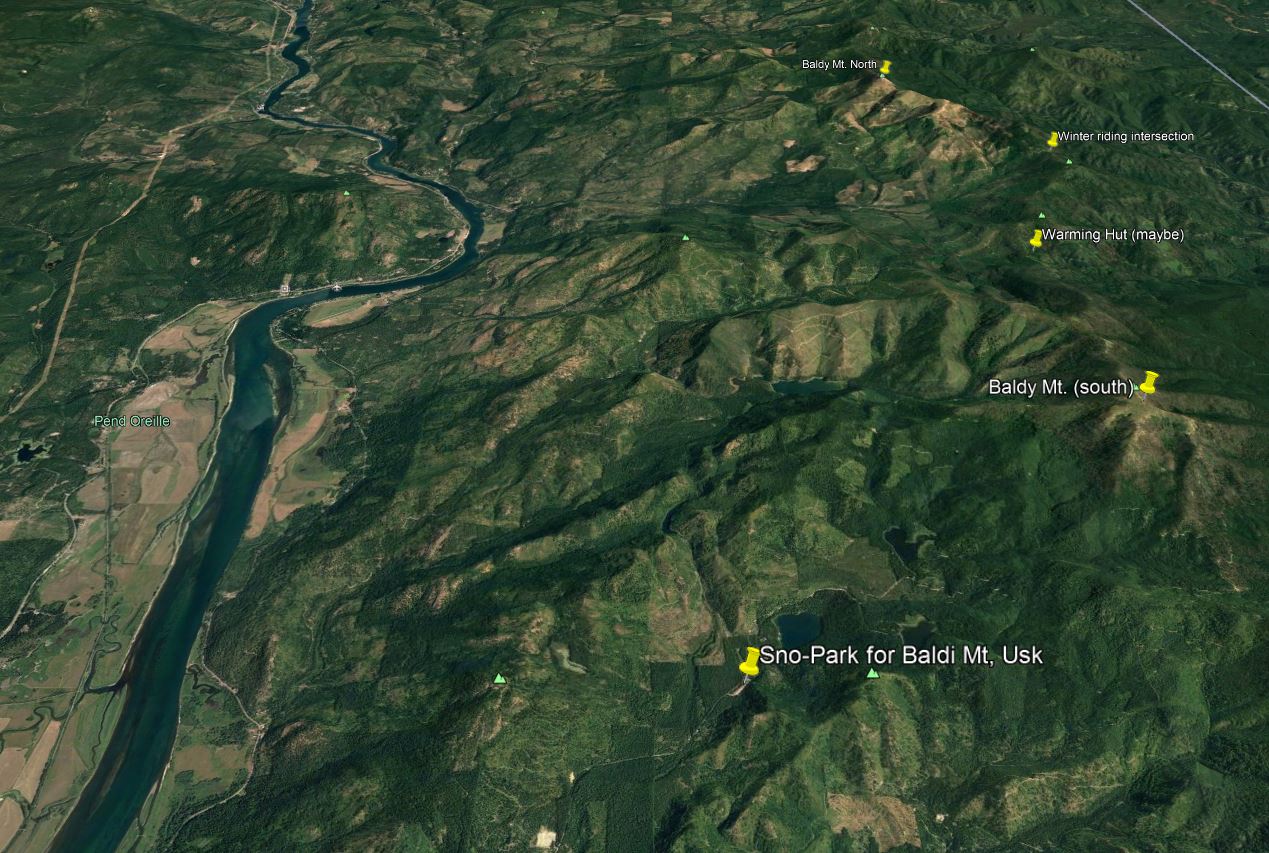
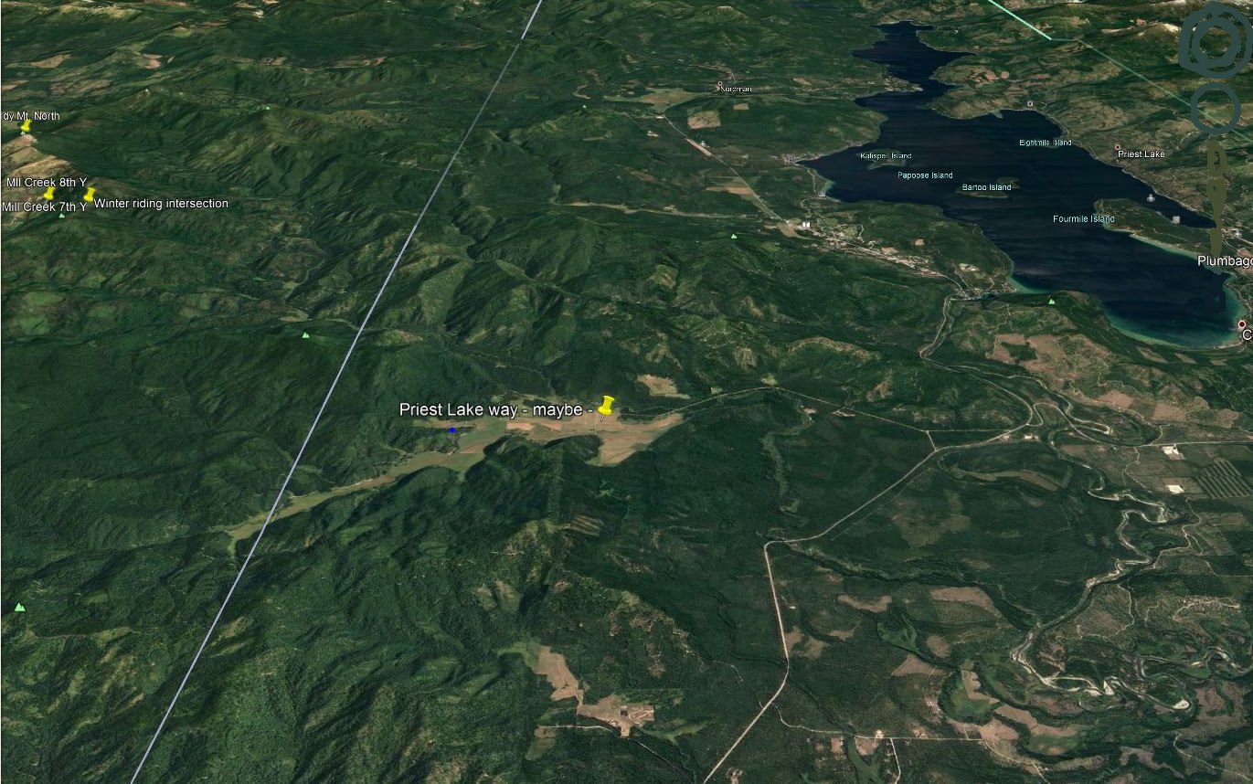
King's lake is a nice area. The sno-park lot has good room for folks, even with a larger trailer. It's also the way to Baldi Mt. both south and north. The Author normally rides the latter located at 48°, 32', 43" North, 117°, 9', 20" West. The top is about 6175' ASL. The "main" intersection is at 48°, 30', 49" North, 117°, 7', 4" West with a height of 5446' and is a good reference for the other trails and meeting area. There is a nice warming hut at one of the intersection in that area as well. Your can also access the area from the Priest Lake area, coming out on the Sqaw Valley road. From this intersection are several more trails and nice off-trail play areas.
From Newport, Wa, head North to Usk (near Cusik). There's a store in town for goodies. After the store head East over the bridge (river) to the stop. For the Kings Lake Sno-Park, continue straight and follow the road to about 3 miles to the Sno-Park area. Unload and get on the main trail going to the North. There may be additional signs at some of the Y's and other intersection to get to the main intersection mentioned above. Along the way is a nice warming hut which is a welcome since some mid-winter days can be windy and cold on top of the mountains. This map shows of the general NE area for the sno-parks
For a more specific map of Kings Lake click on this map for a better view.
Another way is Mill Creek and the other nice part is it appears the Park cops don't check for licenses that smaller parking lot. This can be handy if you don't have a current license for Washington. Of course, those cops can be sneaky and do a surprise inspection there or on the trails.
After crossing the bridge at Usk, turn left onto LaClerc road North. Go 13 1/2 miles and turn right onto the parking area. (a few hundred feet after the sign "Mill Creek" road). This trail is about 10 miles to the intersection mention above. Into about 2 miles, stay to the right, going uphill. During the travel it will open up into a very wide area. Then later it will start climbing going up winding with rather steep edges off the trail, to the right so be careful. Then, take the simple trail to get to the main intersection as mentioned above.
From the East, from Priest Lake, get on Squaw Valley road and go until the snow pack starts to unload there.
Follow the one trail to the main intersection, mentioned above. By the way the intersection is near or at Grouse Knob, according to this map.
The map link below pretty much shows all the access areas; King Lake, Mill Creek and the intersection. The mentioned "warming hut" above may also be called the "Pelke Ridge Hut" according to the map.
Anyway here's the link for this map
We usually decide on a 2-way radio channel to contact on, should we get separated. The Author tends to use channel 7-11 (like the store name) to remember.
![[Kar's sled page]](images/winter_home3.gif)